Automatisiertes Zeichnen von codierten Messdaten direkt in Ihre CAD-Umgebung! In der Funktion Plandraw werden die Daten automatisch auf vordefinierte Layer abgelegt. Nutzen Sie eine Vielzahl an Einstellungsoptionen zur Anpassung Ihrer individuellen Bedürfnisse.
Umfangreiche Zeichnungshilfen zur Umsetzung von Planungs- und Profilzeichnungen! ArchäoCAD unterstützt Sie beim automatischen Schraffieren Ihrer Befunde.
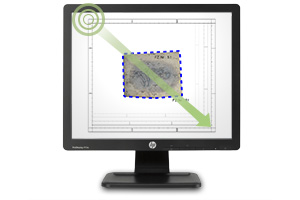
Erstellung von ansprechenden Planlayouts, schnell und einfach! Wählen Sie zunächst den geeigneten Layout-Rahmen und nutzen Sie die Symbolbibliotheken, die vordefinierten Maßstäbe und Nordpfeil-Symbole.
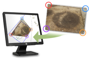
Bildentzerrung leicht gemacht! Mit nur wenigen Klicks entzerren Sie Ihre digitalen Fotos. Rectify ist das Tool für die einfache projektive 2D-Bildentzerrung zur Erstellung von digitalen Bildplänen im CAD.
Generieren Sie verschiedene Zeichnungsrahmen. Erstellen Sie Koordinatenrahmen mit realen Koordinatenwerten (im jeweiligen Koordinatensystem) für einen gewünschten Bereich. Koordinaten, Messgitter und weitere Details können Sie zuschalten. Analog zum Koordinatenrahmen erzeugen Sie Profilrahmen mit Längen- und Höhenangaben.
Tagesschulungen bis zu 4 Teilnehmer werden individuell auf Ihren Wissensstand und Ihre Bedürfnisse zugeschnitten. Dabei legen wir Wert auf eine ausgewogene Mischung aus Theorie und Praxis – von CAD, ArchäoCAD, Vermessung, Tachymetrie etc.
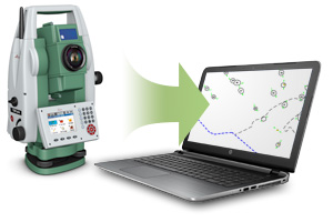
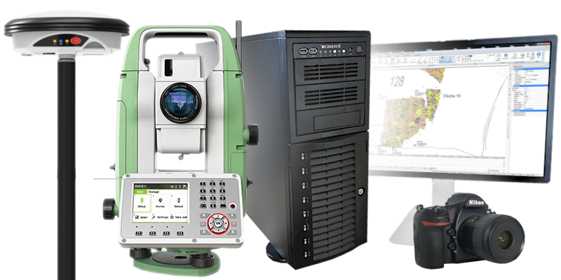
Vom Tachymeter bis zum Notebook – kaufen Sie Ihre Hardware bei uns ein! Wir kennen den Markt und wissen, welche Geräte für Ihre Zwecke am Besten geeignet sind. Sie erhalten fachkundige Beratung gezielt für Archäologen und Vermesser mit Fokus auf das beste Preis-/Leistungsverhältnis.
Rundum-Sorglos-Paket GRATIS beim Kombi-Kauf von Software und PC/Laptop! Wir liefern Ihnen die Hardware fertig aufgesetzt und die Software bereits installiert. Für Sie bedeutet das: einschalten und sofort loslegen!
Für Angebote und Rabatt-Aktionen stöbern Sie doch auf unserer Angebots-Seite.